
Run:
Forecast Hour
Valid:
Parameter
Upper-Air: Height, Wind, Temperature
Height and Wind
Height Tendency
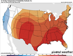
Anomalies
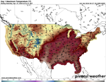
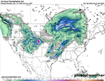
Surface and Precipitation
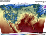
Surface
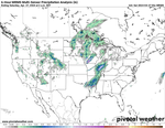
Precipitation Type
Quantitative Precipitation
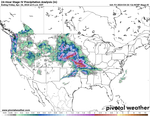
Integrated Moisture and Satellite
Anomalies
Upper-Air: Dynamics
Height and Vorticity
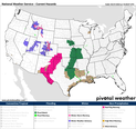
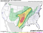
Severe Weather
Winter Weather
Cursor readout
Click for sounding
Zoom menu
previous forecast hour
<
next forecast hour
>
previous run
[
next run
]
toggle readout
r
Model ►
Zoom ►
Animation ►
